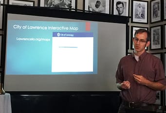
 Micah Seybold loved maps from an early age. In university geography class he got serious about his interest and abandoned his plan to be a computer programmer. However, his tech background did come in handy and lead to a GIS mapping job with the city of Lawrence. Micah Seybold presides over a varied collection of digital maps, all of which are accessible by computer and even by smart phone. The goals of his department include simplifying public access to city maps, eliminating the need for paper maps, and integrating GIS resources with business processes. Each day he handles map and data information requests, catalogs related materials, performs spatial analysis, and strives to optimize workflow. The use of digitalized maps and data saves time by creating efficiencies. For example, digital maps may be used to design efficient service routes for transit or delivery of other services. The city makes available a number of downloadable and interactive maps, including census tracts, bikeways, flood plains, crime, cemetery, tax districts, transit routes and more. Users may customize maps by employing measurements, drawing on maps and even layering different maps. Maps may be printed to PDF, JPG or other file formats. All of these resources and assistance in using them are available at Lawrenceks.org/maps.